SPATIAL MEMORY INFRASTRUCTURE · 2026

Give AI memory of spatial causality.Perceive, reason and act in the real world.

uBuilder-AI is not a 3D modelling tool.
It turns physical space into persistent, queryable, reasonable and actionable spatial memory.

37.230° N / 121.473° ESPACE MODEL · LIVE
uStudio · Spatial Intelligence Hub
SPATIAL MEMORY LIVE
ONTOLOGY IN MOTION
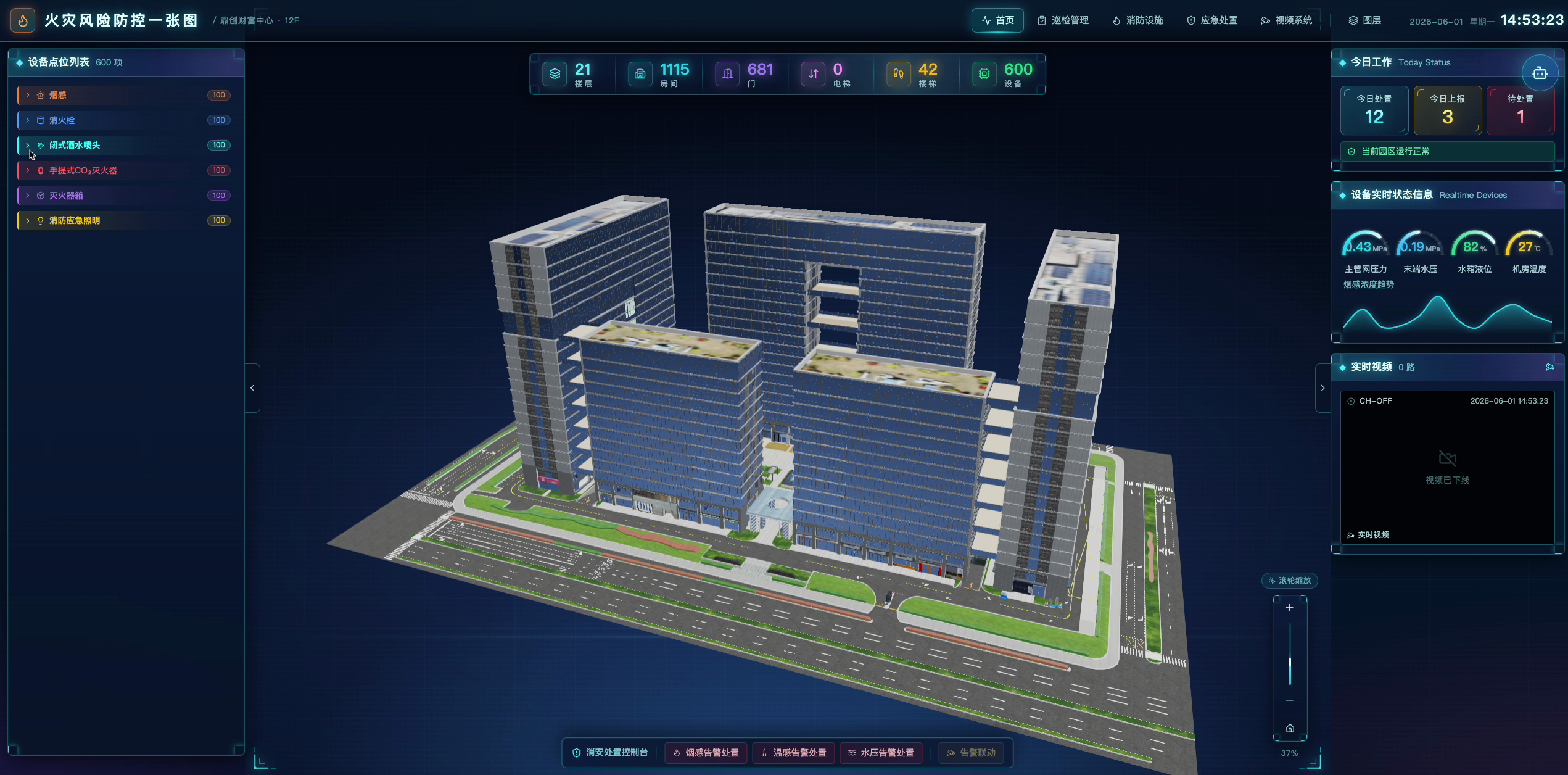
ONTOLOGY21F · 1,115 spacesSemantic model synchronized
AGENT STATUSRisk inspection running 12 tasks orchestrated
SPATIAL MEMORY STACK
DEVICEu360-AI
BUILDuBuilder-AI
ONTOLOGYuStudio
AGENTuJarvis
EMBODIEDuRobot
CHAPTER01

WORLD MODEL

World models: spatial memory and causality

Not a 3D copy of reality, but a continuously updated spatial memory of identity, location, relationships, events and the consequences of action.

BEYOND 3D MODELLING

3D reproduces the world.Spatial memory lets AI understand it.

Move beyond “looks right” to knowing what it is, where it is, and how it changes.

THE MISSING LAYER FOR PHYSICAL AI

Language models remember words.Spatial AI remembers the world.

Spatial memory is neither a video archive nor simply high-fidelity 3D reconstruction. Geometry answers “where,” semantics answers “what and how things relate,” and continuously updated state answers “what changed.” Together they give AI physical-world context it can query, reason over and act upon.

SPATIAL MEMORY / WORLD STATECONTINUOUSLY UPDATED
01IDENTITY

What it is

Object identity and semantic type remain consistent across systems.

02LOCATION

Where it is

Coordinates, spatial hierarchy and topology share one anchor.

03RELATION

How it relates

Assets, spaces, events and operations form computable relationships.

04STATE

What changed

Live state and change history continuously update one world model.

OUR THESIS

We do not turn space into a model to look at. We turn it into a memory AI can continuously understand and act upon.

A WORLD AI CAN READ

Not isolated tables.One semantic world graph.

Rooms, walls, doors, cameras, robots and operational events become nodes. “Located in,” “covers,” “triggers” and “dispatches” become relationships. AI sees a spatial world it can understand, query and reason over—not isolated records.

150+OT protocols
50+IT data sources
10+IoT protocols
01Objects · properties · links02Actions · functions · rules03Geometry · topology · live state
uStudioWorld stateONTOLOGY
contains
located in
connects
monitors
triggers
dispatches
01Building
02Floor
03Space
04Asset
05Sensor
06Person
07Event
08Robot

A spatial ontology does not only describe the world. It defines how the world can be changed.

CHAPTER02

SYSTEM ARCHITECTURE

A computable spatial intelligence system

One world state connects spatial data, cognition, physics, knowledge and embodied execution instead of leaving each capability isolated.

THE COMPLETE SPATIAL STACK

One spatial ontology.Perception, reasoning, simulation and action—connected.

Spatial data, cognition, physics, knowledge and embodied execution share one world state, creating a continuous Real → Sim → Train → Deploy → Real loop.

01 · Spatial data02 · Spatial cognition03 · Spatial physics04 · Spatial knowledge05 · Embodied execution
CHAPTER03

STEP 01 · PERCEPTION

Perception and organization of the physical world

u360 and uBuilder-AI produce spatial data; uStudio gives every object ontology, topology and continuously updated state.

ONE STACK · FOUR PRODUCTS

Capture a space.Then let the space run itself.

00 / PHYSICAL CAPTURE LAYER

uBuilder-AI startswith spatial capture hardware.

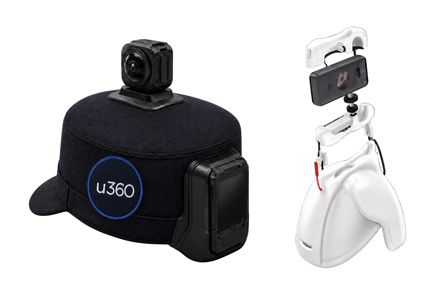
u360-AI is the physical gateway to spatial memory.

Wearable and shoulder-mounted devices capture panoramic vision, pose trajectories and site conditions together, giving AI a first-person understanding of the physical world.

  • 01Wearable and shoulder-mounted form factors
  • 02Panoramic vision + synchronized SLAM pose
  • 03One capture-to-recognition-to-model pipeline
01u360-AICapture physical space
02uBuilder-AIProduce space with AI
03SPATIAL MEMORYBuild computable spatial memory
WEARABLE 360°
SHOULDER RIG
u360-AI wearable and shoulder-mounted spatial capture devices
HARDWARE · 01FIELD READY
01 / CAPTURE & BUILD

u360+
uBuilder-AI

Panoramic capture. AI-native spatial production.

Walk through once with a panoramic camera. SLAM reconstructs the path and aligns it with drawings; detected assets, risks and structures inherit real coordinates. AI produces editable, measurable spatial components that conform to ontology constraints—not a rendered picture.

  • Video becomes localization; trajectories align with drawings
  • Capture becomes annotation with targets and 3D coordinates
  • Conversational and manual editing share one canvas
u360 · REAL-WORLD CAPTUREPANORAMA · MOBILE COLLECTION
CAPTURING
u360-AI · SLAMTRAJECTORY · POSITION
SPACE ALIGNED
uBuilder-AIAI RECOGNITION
AI RECOGNITION
02 / ONTOLOGY & DATA

uStudio

The spatial ontology data platform and structured center of spatial memory.

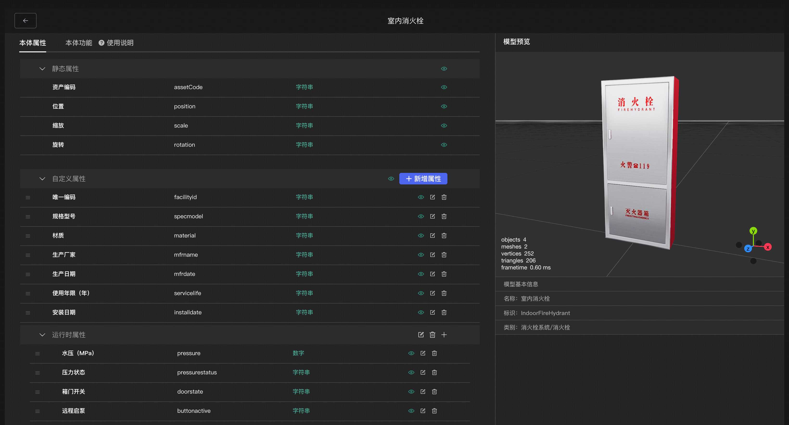
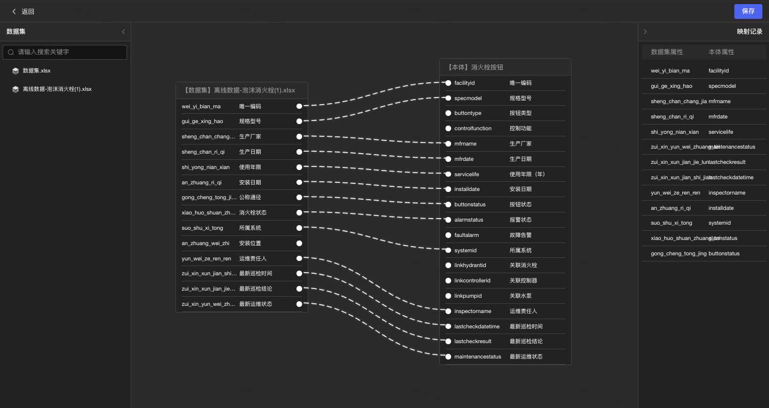
Define type libraries, properties, relationships, geometric constraints and dictionaries once, then apply them everywhere. Buildings, assets, operations and live data map to one semantic model so every spatial object can be visualized, identified, queried and computed continuously.

  • Unified ontologies for spaces, assets and operations
  • Unified mapping across formats, protocols and business data
  • Version anchoring and governed data boundaries
CHAPTER04

STEP 02 · INTELLIGENCE

Spatial reasoning, physical prediction and embodied execution

uJarvis programs with spatial context, uNewton predicts physical change, and uRobot returns decisions to the real world.

03 / SPATIAL AGENT

uJarvisProgram space in natural language.

Like WorkBuddy, but built for the physical world.

Everyday chat and spatial programming share the same models, MCP and Skills. One sentence generates a complete application with a 3D scene, spatial computation and business logic—ready to run, edit and retain.

uJarvis · Spatial Workspace
ChatSpatial programming
AGENT ONLINE
SPATIAL PROGRAMMING
“Build a fire-inspection overview for the current scene.”8 / 8 tools completed
01

Applications from one sentence

No coding or knowledge of the underlying spatial algorithms required.

02

MCP + Skills orchestration

Every spatial capability becomes a composable standard tool.

03

Applications become data sources

New operational data continuously flows back into the ontology.

78 STANDARD SPATIAL SKILLS

78 standard spatial capabilities for agentic action.

From data access and physics simulation to robot execution, every capability can be discovered, composed and invoked by uJarvis.

0119

FOUNDATION API

Foundation APIs

  • Buildings, floors, spaces & assets
  • CCTV and live IoT data
  • Indoor maps and evacuation guides
  • Live people and asset locations
0215

ADVANCED API

Advanced APIs

  • Optimal routing and spatial search
  • AI video analysis
  • Vulnerability and isolation analysis
  • Ontology-based spatial queries
0316

SIMULATION API

Simulation APIs

  • Fire, smoke and evacuation
  • Fluid, gas and 4D construction
  • Asset placement and camera coverage
  • Robot patrol and scenario exploration
0410

LIVE ANALYTICS

Live analytics

  • IoT and CCTV event streams
  • Congestion and energy trends
  • Degradation and risk alerts
  • Presence detection and incident reports
055

PHYSICAL AI

Physical AI integration

  • Agent registration and localization
  • Navigation task dispatch
  • Control and sensor exchange
  • Agent state queries
0613

AGENT ACTION

AI agent execution

  • Plan execution and automated reports
  • Event causality and state reasoning
  • System and asset deployment optimization
  • Patrol and protection optimization

PHYSICS-AWARE INTELLIGENCE

Understand space.Predict what comes next.

uNewton sends native spatial data into professional engines such as FDS, CFD and finite element solvers. Surrogate models accelerate fire spread, evacuation, urban wind and asset-layout studies so AI can decide before action begins.

≤ 3sPrediction response per scenario
≥ 85%Fire-situation prediction accuracy
PHYSICS IN MOTION
uNewton · PHYSICAL SIMULATIONDigital world, measurable consequences.

PHYSICS OPERATOR STACK

From professional solvers to a Transformer physics operator.

FDS, CFD and finite-element solvers generate trusted high-fidelity spatiotemporal fields. A Transformer-based physics operator learns the relationship between field variables, boundary conditions and spatial topology, accelerating hours of solving into seconds of inference.

01SOLVE

High-fidelity solve

FDS · CFD · FEM

02LEARN

Spatiotemporal learning

Transformer Physics Operator

03INFER

Real-time inference

≤ 3s

FDS · CASE 02
02 / FDS SEQUENCE

FDS · CASE 02

OBSERVED 05–09 · PREDICTED 10–59

FDS · CASE 03
03 / FDS SEQUENCE

FDS · CASE 03

OBSERVED 05–09 · PREDICTED 10–59

OBSERVED FRAMESTRANSFORMER PREDICTIONFDS · SPATIOTEMPORAL FIELD

ONLINE PHYSICS LAB

Operate the model and watch the spatial field evolve.

Rotate the 3D volume and run a 100-step simulation to see how the trained physics operator infers future field states.

Enter interactive simulation
INTERACTIVE · ROTATE / ZOOM / TIMELINE
ISAAC TRAINING
FIELD OPSFACTORY INSPECTION
LIVE
PATH READYIsaac waypoint replay

04 / EMBODIED INTELLIGENCE

uRobotBrings spatial intelligence into the physical world.

An embodied-intelligence training and validation pipeline integrated with NVIDIA Isaac. Real uStudio semantic scenes enter simulation for route planning, waypoint replay, visibility checks and evaluation before gradual transfer to ROS 2 and field robots.

uStudio scene packIsaac SimPolicy validationPhysical execution
CHAPTER05

APPLICATIONS

Spatial intelligence in practice

The same spatial memory supports emergency decisions, industry and energy, urban infrastructure and embodied intelligence—not only inspection.

ONE INTELLIGENCE · MANY SPACES

From emergency decisions to production optimization, one spatial intelligence serves many worlds.

01 / EMERGENCY
01 / EMERGENCY

Emergency & public safety

Digital preplans, fire and smoke prediction, evacuation and coordinated response share one world state.

02 / INDUSTRY & ENERGY

Industry & energy

Diagnostics, asset layout, production optimization and robot collaboration run on a computable spatial ontology.

03 / CITY & INFRASTRUCTURE

City & infrastructure

Water, transport, campuses and city operations move from static visualization to reasoning and prediction.

Digital preplansFlood simulationEnergy optimizationProduction schedulingCrowd evacuationRobot coordinationAsset layoutCity operationsDigital preplansFlood simulationEnergy optimizationProduction schedulingCrowd evacuationRobot coordinationAsset layoutCity operations

FROM LANGUAGE TO SPACE

Give AI a memory of the real world.Make every space understandable and actionable.

Back to the beginning